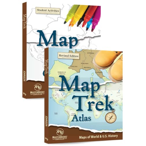

This full-color historical atlas is amazing! You’ll find chronological maps (beginning with the days of Noah) divided into 4 time periods: Ancient, Medieval, New World, and Modern World. Over 200 high-resolution maps show the world during specific slices of time. Free lesson plans available online with suggested activities for all ages and for each map. Can be used flexibly alongside any history curriculum. The Outlines book contains 200 blank outline maps that directly match the colored/labeled ones in the main book. It is flexible and can be used by all ages for locating, coloring, drawing, labeling, and many other activities!
Map Trek Revised Edition Set
SKU
MBMPRS
Grade 5-12
These icons are designed to help you quickly understand and learn important information about our products.
Teaching Method
Traditional
Teacher-centered curriculum commonly used in classrooms that may include a text, teacher manual, tests, etc.
Charlotte Mason
A methodology based on the work of a 19th century educator who maintained that children learn best from literature (Living Books), not textbooks.
Classical
A methodology based on the Latin Trivium (three stages of learning), including the grammar stage (memorization and facts), logic stage (critical thinking), and rhetoric stage (developing/defending ideas).
Unit Study
A thematic or topical approach centered around one topic that integrates multiple subject areas.
Montessori (Discovery)
A methodology based on the work of a 20th century educator that emphasizes student and sensory-driven discovery learning and real-life applications.
Other
Other methodologies
Religious Content
Secular
Contains content contrary to common Christian beliefs (i.e. evolution).
Neutral
Avoids religious or theoretical topics or presents multiple viewpoints without preference.
Christian/Religious
Faith-based or including instructional religious content.
Learning Modality
Auditory
Learns through listening, talking out loud or reading out loud.
Visual
Learns through seeing, prefers written instructions and visual materials.
Kinesthetic/Tactile (Hands-On)
Learns through moving, doing and touching.
Multi-Sensory
Curriculum that employ a variety of activities/components.
Presentation
Sequential
Curriculum progresses through well-defined learning objectives. Emphasizes mastery before moving to the next topic.
Spiral
Topics and concepts are repeated from level to level, adding more depth at each pass and connecting with review.
Conceptual/Topical
Focus is on the “why,” often with a unifying concept as well as specific skills; coverage may be broader.
Teacher Involvement
Low Teacher Involvement
Student-led materials; parent acts as a facilitator.
Medium Teacher Involvement
A mix of teacher-led time and independent student work.
High Teacher Involvement
Teacher-led lessons; may utilize discussions, hands-on activities and working together.
Additional Materials Required
No other materials needed
Everything you need is included.
Other Materials Required
There are additional required resources that are a separate purchase.
Other Materials Optional
There are additional resources mentioned or recommended but are not absolutely necessary.
Consumable
Consumable
Designed to be written in; not reusable.
Non-Consumable
Not designed to be written in; reusable.
Our Price
$85.98 $85.98 $61.50
Rainbow Savings: $24.48
Description
Publisher's Description of Map Trek Revised Edition Set
The Map Trek Set includes an atlas of historical maps from Creation to the present and a book of student activities. This is a resource any parent or teacher can easily use while teaching history or geography with brilliant success. Students of every age will benefit from the full-color maps and outlines.
Map Trek includes over 200 full-color maps, divided into four periods of time: Ancient World, Medieval World, New World, and Modern World. There is a comprehensive table of contents to help you find exactly what you need.
This highly useful map book for home educators was created for those who say they want:
- Historical maps that navigate through history
- Accurate maps that show the world THEN and NOW
- High resolution maps
- Blank maps on perforated pages
The Map Trek Set is designed to help your students:
- Develop critical thinking skills
- Understand a large amount of information presented in a compact form
- Increase interest and engagement with the material, whether teacher-led or independent study
- Quickly make connections between what they have read and its impact in the real world
- Learn to use spatial skills in relation to scale and distance
- Process mental mapping and visualization skills
Category Description for Map Trek Revised by Master Books
A perfect supplement to any history or geography curriculum, Map Trek is a unique atlas that includes historical maps that show the world from the days of Noah through the Iraqi conflict in 2003. It also includes a map of the United States as well as individual state maps. Two components are available: the Atlas and the Outlines Book. These may be used together or independently to meet your family’s needs. If you would like to use as a stand-alone resource, free Lesson Plans are available on our website or from the publisher.
Details
| Product Format: | Product Bundle |
|---|---|
| Grades: | 5-12 |
| Brand: | Rainbow Resource Center |
Videos
Reviews