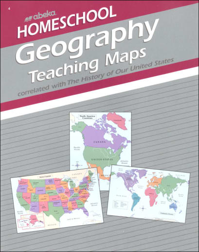
Includes 16 colorful perforated charts made of glossy thin paper. One side is the labeled teaching map, and the other side is unlabeled. Maps include: The World, North America (physical and political), Early Settlements, 13 Original Colonies, How Our Nation Grew, Landforms, and the United States. Use for review, practice, quizzes, or games. Correlates with Abeka's The History of Our United States curriculum.
Abeka Geography Homeschool Teaching Maps
SKU
047816
Grade 4
These icons are designed to help you quickly understand and learn important information about our products.
Teaching Method
Traditional
Teacher-centered curriculum commonly used in classrooms that may include a text, teacher manual, tests, etc.
Charlotte Mason
A methodology based on the work of a 19th century educator who maintained that children learn best from literature (Living Books), not textbooks.
Classical
A methodology based on the Latin Trivium (three stages of learning), including the grammar stage (memorization and facts), logic stage (critical thinking), and rhetoric stage (developing/defending ideas).
Unit Study
A thematic or topical approach centered around one topic that integrates multiple subject areas.
Montessori (Discovery)
A methodology based on the work of a 20th century educator that emphasizes student and sensory-driven discovery learning and real-life applications.
Other
Other methodologies
Religious Content
Secular
Contains content contrary to common Christian beliefs (i.e. evolution).
Neutral
Avoids religious or theoretical topics or presents multiple viewpoints without preference.
Christian/Religious
Faith-based or including instructional religious content.
Learning Modality
Auditory
Learns through listening, talking out loud or reading out loud.
Visual
Learns through seeing, prefers written instructions and visual materials.
Kinesthetic/Tactile (Hands-On)
Learns through moving, doing and touching.
Multi-Sensory
Curriculum that employ a variety of activities/components.
Presentation
Sequential
Curriculum progresses through well-defined learning objectives. Emphasizes mastery before moving to the next topic.
Spiral
Topics and concepts are repeated from level to level, adding more depth at each pass and connecting with review.
Conceptual/Topical
Focus is on the “why,” often with a unifying concept as well as specific skills; coverage may be broader.
Teacher Involvement
Low Teacher Involvement
Student-led materials; parent acts as a facilitator.
Medium Teacher Involvement
A mix of teacher-led time and independent student work.
High Teacher Involvement
Teacher-led lessons; may utilize discussions, hands-on activities and working together.
Additional Materials Required
No other materials needed
Everything you need is included.
Other Materials Required
There are additional required resources that are a separate purchase.
Other Materials Optional
There are additional resources mentioned or recommended but are not absolutely necessary.
Consumable
Consumable
Designed to be written in; not reusable.
Non-Consumable
Not designed to be written in; reusable.
Our Price
$15.45 Description
Publisher's Description of Abeka Geography Homeschool Teaching Maps
This handy book of 8 brightly colored teaching visuals (labeled on one side and unlabeled on the other) helps your child master geography facts. Reinforce locations of the world's regions, countries, oceans, landforms, and more as taught in the Homeschool History/Geography 4 Curriculum and The History of Our United States in Christian Perspective textbook. The unlabeled side is great for reviews. The perforated pages make it easy if you prefer to remove individual pages to display on the wall. The 8½" x 11" size makes it easy to store detached pages in page protectors. Gr. 4.
Featured Maps and Charts
The World—Physical (continents and oceans)
North America–Physical (mountains and bodies of water)
North America–Political (countries)
Early Settlements (New World)
The 13 Colonies (New England, Middle, Southern)
Our Nation Grows (U.S. land acquisitions after 13 original colonies)
Landforms (geographical terms such as oasis, delta, peninsula)
United States–Political (states and capitals)
Category Description for Abeka History & Geography Grade 4
Presents American history from a biblical, patriotic view. Highlighting the main events, lessons begin with "Years of Discovery" and end with "Freedom and Responsibility". Key concepts and vocabulary words are summarized in each chapter. Review questions and end of chapter questions are also included along with map exercises. Eight historical documents for memorization and a state history study are also incorporated. My State Notebook is a resource used with this curriculum.
Details
| Product Format: | Other |
|---|---|
| Grade: | 4 |
| Brand: | Abeka |
| Length in Inches: | 11 |
| Width in Inches: | 8.5 |
| Height in Inches: | 0.125 |
| Weight in Pounds: | 0.2 |
Videos
Reviews