From that mogul of maps, Josh Wiggers (of Geography Matters), comes this valuable resource with over 130 reproducible maps. Need a map for Hannibal's travels, hurricane tracking, or habitat studies? It's here! No more wasted time searching for that elusive map of the ancient Middle East! Includes maps of each of the fifty states, continents, ancient historical regions, historical war regions, and more.
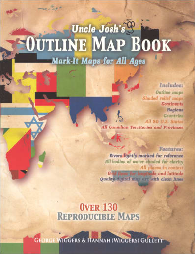
Uncle Josh's Outline Map Book
SKU
003136
ISBN
9781628630008
Grade PK-AD
These icons are designed to help you quickly understand and learn important information about our products.
Teaching Method
Traditional
Teacher-centered curriculum commonly used in classrooms that may include a text, teacher manual, tests, etc.
Charlotte Mason
A methodology based on the work of a 19th century educator who maintained that children learn best from literature (Living Books), not textbooks.
Classical
A methodology based on the Latin Trivium (three stages of learning), including the grammar stage (memorization and facts), logic stage (critical thinking), and rhetoric stage (developing/defending ideas).
Unit Study
A thematic or topical approach centered around one topic that integrates multiple subject areas.
Montessori (Discovery)
A methodology based on the work of a 20th century educator that emphasizes student and sensory-driven discovery learning and real-life applications.
Other
Other methodologies
Religious Content
Secular
Contains content contrary to common Christian beliefs (i.e. evolution).
Neutral
Avoids religious or theoretical topics or presents multiple viewpoints without preference.
Christian/Religious
Faith-based or including instructional religious content.
Learning Modality
Auditory
Learns through listening, talking out loud or reading out loud.
Visual
Learns through seeing, prefers written instructions and visual materials.
Kinesthetic/Tactile (Hands-On)
Learns through moving, doing and touching.
Multi-Sensory
Curriculum that employ a variety of activities/components.
Presentation
Sequential
Curriculum progresses through well-defined learning objectives. Emphasizes mastery before moving to the next topic.
Spiral
Topics and concepts are repeated from level to level, adding more depth at each pass and connecting with review.
Conceptual/Topical
Focus is on the “why,” often with a unifying concept as well as specific skills; coverage may be broader.
Teacher Involvement
Low Teacher Involvement
Student-led materials; parent acts as a facilitator.
Medium Teacher Involvement
A mix of teacher-led time and independent student work.
High Teacher Involvement
Teacher-led lessons; may utilize discussions, hands-on activities and working together.
Additional Materials Required
No other materials needed
Everything you need is included.
Other Materials Required
There are additional required resources that are a separate purchase.
Other Materials Optional
There are additional resources mentioned or recommended but are not absolutely necessary.
Consumable
Consumable
Designed to be written in; not reusable.
Non-Consumable
Not designed to be written in; reusable.
Our Price
$19.95 $19.95 $15.75
Rainbow Savings: $4.20
Description
Publisher's Description of Uncle Josh's Outline Map Book
Outline maps are a foundational part of teaching geography and history. Here are hundreds of maps to use year after year, regardless of topic or time studied. From drawing explorer's routes to tracking hurricanes to depicting the rise and fall of empires, it's here! Includes continents, ancient historical regions, important war arenas, each of the fifty states, and more! Rivers are lightly shaded and surrounding borders are visible. You've got the whole world covered! Reproducible pages.
The book edition contains 130+ reproducible blank grayscale maps, while the Collection CD and Digital Download version has more than 260—including shaded relief maps of the world and each continent, many colored labeled maps, and also maps of each U.S. state and the Canadian provinces and territories.
NOTE: the physical book version and its variants do not include any colored maps. Color maps are in the complete map Collection on CD or Digital Download only.
Category Description for Trail Guide to World Geography
The Trail Guide to World Geography blazes a trail through geography - all you have to do is follow it! Author Cindy Wiggers has done a terrific job of combining questions, mapping, and other activities into a fun, easy-to-teach approach to geography. Intended as a 36-week program, the first 27 of these include a variety of activities. The first weeks encompass the world as a whole; then you focus on different regions continent by continent. Within each week there are several different methods of learning. One of these, Geography Trails, provides questions four days a week that will improve the student's ability to use maps to locate countries, capitals, bodies of water, and landforms, teach them valuable geography terms and learn many geography facts. Different questions are given for grades 2-4, 5-7, and 8-10, so that you can use this book for children at different levels at the same time. Additional geography activities for every week are in the form of "Points of Interest," where you can take time to learn more extensively. Activities to choose from include mapping, researching, suggestions for art projects, and weekly projects to compile into your very own geography notebook. Then it's geography through literature for the last nine weeks as you read through Around the World in 80 Days. Questions for each chapter are provided, as are ideas for additional research and spelling and vocabulary words.
Please note that that this course provides a framework for studying world geography, and relies on additional resources for reference, maps, and activities. Required resources include: Around the World in 80 Days by Jules Verne if you are planning on completing the literature portion of the study and an age-appropriate world atlas, Suggested atlases are listed below. Three "key" recommended resources you will rely heavily on for many of the activities include the Ultimate Geography and Timeline Guide, Uncle Josh's Map Book (in book form, or CD-ROM), and Visual Manna's Teaching Geography Through Art (for the art in geography lessons). Although you could make the study work without these, they are often referred to in the lessons, and the program would work much more easily with them. These and other recommended resources are listed below, including atlases for students of different grades. Please note that the Jr. Classroom Atlas and Classroom Atlas are identical to the World Atlas Know Geography (Grades 1-3 and 4-9), respectively. The Atlas of World Geography and the World Atlas Know Geography for high school are almost identical with just a few textual changes. An almanac is also recommended, in case you don't have one on hand, we recommend the World Almanac & Book of Facts. A Geographical Terms chart is also recommended; we are unable to offer this specific one, but it is available from Geography Matters.
Uncle Josh's Outline Map Book is a valuable resource book that contains over 130 reproducible maps (each of the fifty states, continents, ancient historical regions, and more). Uncle Josh's Outline Map Collection, in CD-ROM format, contains over 260 printable maps (including all those in the book). Requirements: Windows 95 or later; OS 9 or later; Acrobat 5.0 or above (included); and an inkjet or laser printed (recommended). Both sets are also available in digital download format. ~Stephanie
Details
| Product Format: | Softcover Book |
|---|---|
| Grades: | PK-AD |
| Brand: | Geography Matters |
| Author: | George Wiggers |
| ISBN: | 9781628630008 |
| Length in Inches: | 11.125 |
| Width in Inches: | 8.625 |
| Height in Inches: | 0.5 |
| Weight in Pounds: | 0.8813 |
Videos
Reviews