ArtK12 Draw Canada and Greenland guides your student as they draw a map of Canadian provinces plus the island of Greenland on a single sheet of blank paper. Step-by-step instruction is shown in red, moving incrementally through drawing the entire map. Students feel successful! Interesting blurbs add interest and prompt further exploration on the topic. Reproducible templates in the back can get you started. ~Sara
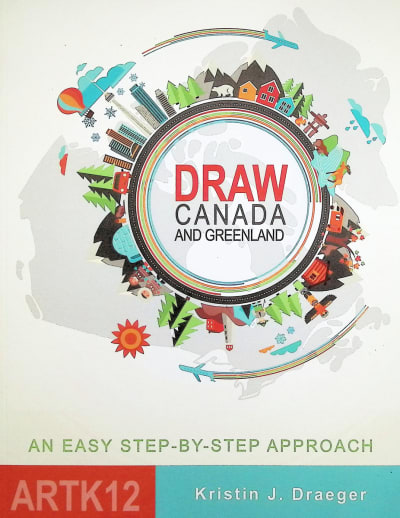
ArtK12: Draw Canada and Greenland
SKU
064783
ISBN
9781517193317
Grade 3-8
Neutral
Low Teacher Involvement
Multi-Sensory
Other Materials Required
Conceptual/Topical
These icons are designed to help you quickly understand and learn important information about our products.
Teaching Method
Traditional
Teacher-centered curriculum commonly used in classrooms that may include a text, teacher manual, tests, etc.
Charlotte Mason
A methodology based on the work of a 19th century educator who maintained that children learn best from literature (Living Books), not textbooks.
Classical
A methodology based on the Latin Trivium (three stages of learning), including the grammar stage (memorization and facts), logic stage (critical thinking), and rhetoric stage (developing/defending ideas).
Unit Study
A thematic or topical approach centered around one topic that integrates multiple subject areas.
Montessori (Discovery)
A methodology based on the work of a 20th century educator that emphasizes student and sensory-driven discovery learning and real-life applications.
Other
Other methodologies
Religious Content
Secular
Contains content contrary to common Christian beliefs (i.e. evolution).
Neutral
Avoids religious or theoretical topics or presents multiple viewpoints without preference.
Christian/Religious
Faith-based or including instructional religious content.
Learning Modality
Auditory
Learns through listening, talking out loud or reading out loud.
Visual
Learns through seeing, prefers written instructions and visual materials.
Kinesthetic/Tactile (Hands-On)
Learns through moving, doing and touching.
Multi-Sensory
Curriculum that employ a variety of activities/components.
Presentation
Sequential
Curriculum progresses through well-defined learning objectives. Emphasizes mastery before moving to the next topic.
Spiral
Topics and concepts are repeated from level to level, adding more depth at each pass and connecting with review.
Conceptual/Topical
Focus is on the “why,” often with a unifying concept as well as specific skills; coverage may be broader.
Teacher Involvement
Low Teacher Involvement
Student-led materials; parent acts as a facilitator.
Medium Teacher Involvement
A mix of teacher-led time and independent student work.
High Teacher Involvement
Teacher-led lessons; may utilize discussions, hands-on activities and working together.
Additional Materials Required
No other materials needed
Everything you need is included.
Other Materials Required
There are additional required resources that are a separate purchase.
Other Materials Optional
There are additional resources mentioned or recommended but are not absolutely necessary.
Consumable
Consumable
Designed to be written in; not reusable.
Non-Consumable
Not designed to be written in; reusable.
Our Price
$19.95 $19.95 $18.50
Rainbow Savings: $1.45
Product Overview
- Follow step-by-step instructions to draw your own map
- Use your own blank paper and a pencil, then color it as you like!
- Use the template if you need help getting started
Description
Publisher's Description of ArtK12: Draw Canada and Greenland
Geography is essential to a child's education. And basic to that study is a simple outline of provinces, countries and continents. In Draw Canada and Greenland I have tried to give students an easy introduction to committing the map of Canada and Greenland to memory. Through simple, step-by-step instructions, students learn to draw each province and territory as they connect to their neighbors and, with a little practice, will be able to draw Canada and Greenland as a whole.
Category Description for ArtK12 Draw the World Series
ArtK12 Draw the World Series offers a hands-on geography learning experience for students with variable drawing abilities. Every page walks you through drawing one portion of a complete map. You will use your own blank paper and pencil for this part. Shapes are not too precise. An older student can follow an atlas or map reference to add more detail if they wish, while a younger child can focus on more basic outlines of states and countries.
Digital templates are free from the publisher’s website for many of the books. Some have reproducible templates in the back of the book. A child who is not confident diving right in can use these to get started, following the instructions from that point. Others will simply begin and go! You will only need 1 or 2 pieces of paper per student to create these maps. Each drawing step is in red, either dots or lines. When finished, outline your entire map with a marker and have fun coloring it in!
Read the informational blurbs and discuss as you draw. Maybe look up a particular feature and learn more details! Refer to an actual map and look at what surrounds your map. Is it land or ocean? Mountains or plains? Do you know about the animals and people who live there?
Add an ArtK12 book to a unit study about an animal’s habitat, a part of history, or your geography lesson. Your kids will remember the process as much as the product. Maps can be abstract for some learners. Drawing a map themselves is an accomplishment and makes world geography more relatable. Because you are not writing directly in the books, you can keep them for more students to use.
You could finish your map in one sitting, or stretch it out, taking a deeper dive as you go. Draw the World comes with flexibility to make it fit your learners. FYI – the various maps are not in scale to create a large world map.
Details
| Product Format: | Paperback |
|---|---|
| Grades: | 3-8 |
| Brand: | ArtK12 |
| ISBN: | 9781517193317 |
| Length in Inches: | 11 |
| Width in Inches: | 8.5625 |
| Height in Inches: | 0.25 |
| Weight in Pounds: | 0.55 |
Videos
Reviews