We use cookies to make your experience better. To comply with the new e-Privacy directive, we need to ask for your consent to set the cookies. Learn more.
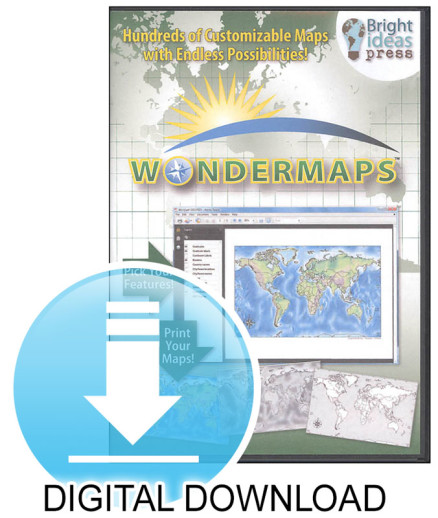
WonderMaps Digital Download
SKU
082644
Grade K-12
These icons are designed to help you quickly understand and learn important information about our products.
Teaching Method
Traditional
Teacher-centered curriculum commonly used in classrooms that may include a text, teacher manual, tests, etc.
Charlotte Mason
A methodology based on the work of a 19th century educator who maintained that children learn best from literature (Living Books), not textbooks.
Classical
A methodology based on the Latin Trivium (three stages of learning), including the grammar stage (memorization and facts), logic stage (critical thinking), and rhetoric stage (developing/defending ideas).
Unit Study
A thematic or topical approach centered around one topic that integrates multiple subject areas.
Montessori (Discovery)
A methodology based on the work of a 20th century educator that emphasizes student and sensory-driven discovery learning and real-life applications.
Other
Other methodologies
Religious Content
Secular
Contains content contrary to common Christian beliefs (i.e. evolution).
Neutral
Avoids religious or theoretical topics or presents multiple viewpoints without preference.
Christian/Religious
Faith-based or including instructional religious content.
Learning Modality
Auditory
Learns through listening, talking out loud or reading out loud.
Visual
Learns through seeing, prefers written instructions and visual materials.
Kinesthetic/Tactile (Hands-On)
Learns through moving, doing and touching.
Multi-Sensory
Curriculum that employ a variety of activities/components.
Presentation
Sequential
Curriculum progresses through well-defined learning objectives. Emphasizes mastery before moving to the next topic.
Spiral
Topics and concepts are repeated from level to level, adding more depth at each pass and connecting with review.
Conceptual/Topical
Focus is on the “why,” often with a unifying concept as well as specific skills; coverage may be broader.
Teacher Involvement
Low Teacher Involvement
Student-led materials; parent acts as a facilitator.
Medium Teacher Involvement
A mix of teacher-led time and independent student work.
High Teacher Involvement
Teacher-led lessons; may utilize discussions, hands-on activities and working together.
Additional Materials Required
No other materials needed
Everything you need is included.
Other Materials Required
There are additional required resources that are a separate purchase.
Other Materials Optional
There are additional resources mentioned or recommended but are not absolutely necessary.
Consumable
Consumable
Designed to be written in; not reusable.
Non-Consumable
Not designed to be written in; reusable.
Our Price
$49.95 Non-returnable: is a digital item.
Description
A customizable collection of more than 300 maps you can integrate into your history, literature, science, current events or Bible studies. This download includes historical and modern maps, 75 world maps, 60 of the U.S., and black/white as well as color maps. You are getting outline, reference, political, and topographical maps all included. The complete map sets to Mystery of History 1-4 and All American History 1 & 2 are here too. This is a versatile tool you are sure to get loads of use from. ~Sara
Please note: Windows 10 and up may have some issues on the install, as Adobe Reader may not be detected. If you run into issues with your digital download, please reach out to us for assistance. There are some additional steps that may be necessary.
Publisher's Description of WonderMaps Digital Download
e-book (not print version). Product is entirely digital.
WonderMaps is a customizable collection of over 300 different maps. With nearly endless possibilities, WonderMaps makes it easy to regularly integrate map study into a variety of lessons and make the most of every learning opportunity. Whether it’s history, literature, science, current events, or Bible, maps play an integral role in thoroughly understanding the topic at hand.
WonderMaps is designed with easy-to-use layers that let you customize each map. And now, you can also edit and annotate your maps before printing! Maps are an integral part of many homeschooling projects, from lapbooksto notebooks to posters. WonderMaps is destined to become a go-to resource! A customizable, printable collection of over 300 maps, WonderMaps includes: Historical and modern-day maps; Outline, reference, political, and topographical maps; Black-and-white and color maps; Features including names, borders, rivers, cities, physical features, and graticules;75 Maps of the World; 60+ USA Maps; 150 Historical Maps, Including 30 Biblical Maps; The complete map sets to accompany The Mystery of History Vol. I-IV and All American History Vol. I & II.
New in version 1.2: you can now edit maps, add text,and draw right in Adobe Reader! Save your additionsand print them, too. Version 1.2 requires Adobe Acrobat Reader DC (a free download) and 350 MB hard drive space to run properly.
Category Description for North Star Geography
Have you ever stopped to realize that a comprehensive understanding of the earth, its structure, and its inhabitants are a necessary foundation for interacting meaningfully with our increasingly global-minded world? Taking an overview approach, the North Star Geography course covers geography skills (reading maps, using geographic tools, cartography, surveying, and navigation), physical geography (geology, meteorology, oceanography, ecology, hydrology, and astronomy), and human geography (sociology, culture, religion, transportation, agriculture, government, and economics). Bright Ideas Press and world geography, what a great idea! The student reader plus companion guide downloadable PDF file include activities, maps, hands-on projects, research options, and quizzes/tests. Features quality content, a Biblical worldview, and user-friendliness all rolled up into one package!
The text or Student Reader is the heart of the course. Each of the sixteen lessons provides 15-20 pages of reading text, full-color illustrations, photos, sidebar articles, and maps. Lessons are divided into teaching segments which are both highly readable and interesting. The organization lends itself to flexibility, and the course could be done over one year (two weeks per lesson), two years (four weeks per lesson), or even one semester (one week per lesson – a bare bones approach). Vocabulary words are in bold, with definitions provided in the glossary at the end of the text. The Reader concludes with a reference list that provides options for further study.
The accompanying companion guide PDF file is now downloadable (download instructions provided inside the book). It provides both basic and "extra" activities in addition to all content from the Reader. It's these PDF files that will allow you to tailor the course for high school, for junior high, or for a combination of ages. Families may make photocopies or print pages as needed, but classrooms and co-ops should contact the publisher for a multiple-use license. Depending on the course time-frame you choose, you will probably have to assign only some selection of activities, as there is a wealth provided.
- Hands-On Activities are varied and plentiful. Some are short and simple, some more involved. Materials lists are provided when necessary (and tend to be easy-to-get items).
- Build Your Own Atlas: there's a segment for each lesson that includes labeling outline maps, completing fact files, and creating a set of political, physical, and thematic maps. Outline maps are provided, but a good atlas as a reference is helpful (i.e. Wondermaps or Atlas of World Geography).
- Note-Taking Pages: each lesson has a set of 10 questions taken from the text that serve as lesson review and a study guide for the quizzes.
- Memorization Lists include a list of 198 countries, 70 regions and physical features to learn roughly 16 items per lesson.
- Research Questions include a set of questions for each continent which encourage the student to conduct his own research (answers included).
- Quizzes and Tests quizzes for each lesson (based on note-taking questions and map work). A final exam includes questions taken from all 16 of the lessons (answer keys and grading rubrics included).
- Graphic Organizers – these can be used for all types of studies world/continent, country, culture, regional geography, and government fact files.
Homeschool geography courses have tended to be research frameworks that can be used by multi-age students, often over several years. While having lots of advantages for families they require planning, preparation, and often outside resources. North Star takes a different approach, providing a very solid base of textual information but giving lots of options for additional activities and research. It provides all necessary forms and pages, requiring only a good world atlas to accompany the course. ~ Janice
Details
| Product Format: | Other |
|---|---|
| Brand: | Bright Ideas Press |
| Grades: | K-12 |
Videos
Reviews