We use cookies to make your experience better. To comply with the new e-Privacy directive, we need to ask for your consent to set the cookies. Learn more.
Wondermaps CD-ROM Version 1.2
SKU
046318
ISBN
9781892427403
Grade K-12
Christian/Religious
Low Teacher Involvement
Multi-Sensory
Conceptual/Topical
These icons are designed to help you quickly understand and learn important information about our products.
Teaching Method
Traditional
Teacher-centered curriculum commonly used in classrooms that may include a text, teacher manual, tests, etc.
Charlotte Mason
A methodology based on the work of a 19th century educator who maintained that children learn best from literature (Living Books), not textbooks.
Classical
A methodology based on the Latin Trivium (three stages of learning), including the grammar stage (memorization and facts), logic stage (critical thinking), and rhetoric stage (developing/defending ideas).
Unit Study
A thematic or topical approach centered around one topic that integrates multiple subject areas.
Montessori (Discovery)
A methodology based on the work of a 20th century educator that emphasizes student and sensory-driven discovery learning and real-life applications.
Other
Other methodologies
Religious Content
Secular
Contains content contrary to common Christian beliefs (i.e. evolution).
Neutral
Avoids religious or theoretical topics or presents multiple viewpoints without preference.
Christian/Religious
Faith-based or including instructional religious content.
Learning Modality
Auditory
Learns through listening, talking out loud or reading out loud.
Visual
Learns through seeing, prefers written instructions and visual materials.
Kinesthetic/Tactile (Hands-On)
Learns through moving, doing and touching.
Multi-Sensory
Curriculum that employ a variety of activities/components.
Presentation
Sequential
Curriculum progresses through well-defined learning objectives. Emphasizes mastery before moving to the next topic.
Spiral
Topics and concepts are repeated from level to level, adding more depth at each pass and connecting with review.
Conceptual/Topical
Focus is on the “why,” often with a unifying concept as well as specific skills; coverage may be broader.
Teacher Involvement
Low Teacher Involvement
Student-led materials; parent acts as a facilitator.
Medium Teacher Involvement
A mix of teacher-led time and independent student work.
High Teacher Involvement
Teacher-led lessons; may utilize discussions, hands-on activities and working together.
Additional Materials Required
No other materials needed
Everything you need is included.
Other Materials Required
There are additional required resources that are a separate purchase.
Other Materials Optional
There are additional resources mentioned or recommended but are not absolutely necessary.
Consumable
Consumable
Designed to be written in; not reusable.
Non-Consumable
Not designed to be written in; reusable.
Our Price
$49.95 $49.95 $44.95
Rainbow Savings: $5.00
Description
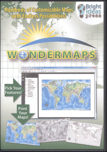
There are times when I pick up a new item and find myself saying "Wow I sure wish this was around when I was being homeschooled!" I loved maps and geography. Actually, I still do. So when I had the opportunity to explore this program, I was very excited. The concept is very simple: these are PDF maps that can be manipulated to show just what you need you can add or subtract names, borders, rivers, color, cities, and physical features at will. With the newest version, you can even edit maps in Adobe Reader and print them. This makes this a fantastic resource for many ages and skill levels and a really great value. There are four main map categories on the home screen: World, USA, Historical, and Thematic. The program includes 75 maps of the world, over 60 USA maps, over 150 historical maps and map sets from Mystery of History. When you click on "World" you are shown a world map with continents and oceans named. You can create a map at that level or click on one of the names to "zoom in" on a particular area. The next map, again, gives you the option to create a map or "zoom in" to get details on a couple of neighboring countries. There are only a couple of instances where the closest "zoom" will show an individual country (like New Zealand, Australia, Ireland/Northern Ireland), most show a continental region (like Southern Africa or Korean peninsula). The USA category can be explored by state or by region. In a similar manner to the countries, states are shown with their neighbors (though neighbors are only labeled with the state name and rivers if selected). The category for historical maps is further divided by time period: Ancient (Creation 33AD), Middle Ages (33 1456), Renaissance and Reformation (1457 1707), and Modern (1708 Present). Thematic maps include American history, Explorers, Native Americans, World Wars, Biblical Maps, 20th Century Treaties, and Chinese Dynasties. You can access different maps through several means. The first is the "zoom in" process described above. The second is via the left-hand navigation that pops up as soon as you select any category. This lists all of the major regions or time periods in the category so you can pick from the list quickly. The third way to access maps is via one of the alphabetical indexes unique to each of the four main categories.
The content doesn't end there. All of the maps used in Mystery of History volumes 1-4 and All American History volumes 1-2 are included in the program. When you select one of those volumes you can either scroll through all of the maps or use the left-hand navigation to find the required map. These maps are not customizable, but are presented as they would be used in the programs.
Another useful feature is the Teacher's Guide. The resources of the TG will be helpful for learning about this program as well as teaching geography in general: quick start guide, tutorial video, user manual, downloadable MP3 workshops on "Loving Geography" and "Packing a Punch with Timelines and Maps", and several lessons adapted from the book "Hands-On Geography": 50 bright ideas for using outline maps, the 5 themes of geography, how to make a salt-dough map, history and geography, 16 easy mapping projects, and Joseph's Journey.
As far as supplemental geography resources go, this one is fantastic in scope and depth. With over 350 different maps and the ability to customize as needed, you can incorporate maps and geography into any lesson with ease. Compatible with Windows through Windows 10 or Mac and requires Adobe Reader 12.0 or higher. ~Zach
Publisher's Description of Wondermaps CD-ROM Version 1.2
Maps are an integral part of many homeschooling projects, from lap books to notebooks to posters. WonderMaps is destined to become a go-to resource!
A customizable, printable collection of over 300 maps, WonderMaps includes:
- Historical and modern-day maps
- Outline, reference, political, and topographical maps
- Black-and-white and color maps
- Features including names, borders, rivers, cities, physical features, and graticules
New in version 1.2: you can now edit maps, add text, and draw right in Adobe Reader! Save your additions and print them, too.
WonderMaps is a customizable collection of over 300 different maps. With nearly endless possibilities, WonderMaps makes it easy to regularly integrate map study into a variety of lessons and make the most of every learning opportunity.
Whether it's history, literature, science, current events, or Bible, maps play an integral role in thoroughly understanding the topic at hand. WonderMaps is designed with easy-to-use layers that let you customize each map. And now, you can also edit and annotate your maps before printing!
WonderMaps includes:
- 75 maps of the world
- 60+ maps of the USA
- 150+ historical maps, including 30 biblical maps
- Map sets from The Mystery of History Volumes I-IV and All American History Volumes I and II
Discover how much excitement maps and geography will add to your learning experience through the amazing features of WonderMaps.
Be sure you are using the most recent version of Adobe Reader.
Details
| Product Format: | CD-ROM |
|---|---|
| Brand: | Bright Ideas |
| Grades: | K-12 |
| ISBN: | 9781892427403 |
| Length in Inches: | 7.5 |
| Width in Inches: | 5.5 |
| Height in Inches: | 0.5 |
| Weight in Pounds: | 0.2 |
Videos
Reviews