Africa Advanced Physical Deskpad
Item #: | 020910 |
---|---|
ISBN: | 9780762548804 |
Grades: | PK-AD |
Product Description:
Publisher Description:
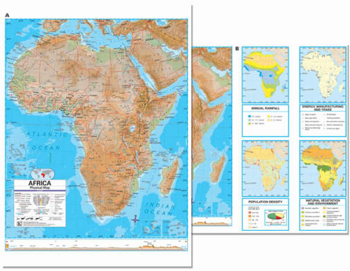
The Africa Advanced Physical Deskpad Map highlights shaded physical relief, an elevation cross-section with color bar, and includes four thematic maps. Side B is unlabeled and perfect for classroom assignments and testing purposes. Corresponds with Advanced Physical Classroom Wall Maps.
These heavy-duty, child-friendly maps measure 17" x 11" and are laminated with a 5mm thick durable surface, that is markable with a dry erase marker or water-soluble pen.
This product is ideal for public, private, parochial, and home schools.
These placemats are double-sided, laminated, and measure 18" x 13.3". All styles are detailed, full-color, and display maps of different areas with latitude and longitude lines. All have legends on the front that tell what the different lines, dots, and colors mean. The physical deskpads have a map of the featured area on one side with countries, cities, rivers, oceans, landforms, and more labeled. The back sides are also full-color and have an unlabeled map of the area, along with additional smaller maps that show annual rainfall, energy/manufacturing/ trade, population density, and natural vegetation/environment. The political maps are a bit more colorful with a similar format. One side displays a labeled map of the area, with pretty much the same features labeled. Then the back shows an unlabeled map and smaller maps that show climate, natural vegetation/environment, landforms/regions, and population density/ethnic diversity. ~ Rachel