We use cookies to make your experience better. To comply with the new e-Privacy directive, we need to ask for your consent to set the cookies. Learn more.
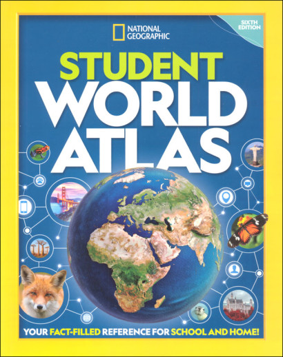
National Geographic Student World Atlas Sixth Edition
SKU
034120
ISBN
9781426373435
Grade 7-12
Neutral
Non-Consumable
These icons are designed to help you quickly understand and learn important information about our products.
Teaching Method
Traditional
Teacher-centered curriculum commonly used in classrooms that may include a text, teacher manual, tests, etc.
Charlotte Mason
A methodology based on the work of a 19th century educator who maintained that children learn best from literature (Living Books), not textbooks.
Classical
A methodology based on the Latin Trivium (three stages of learning), including the grammar stage (memorization and facts), logic stage (critical thinking), and rhetoric stage (developing/defending ideas).
Unit Study
A thematic or topical approach centered around one topic that integrates multiple subject areas.
Montessori (Discovery)
A methodology based on the work of a 20th century educator that emphasizes student and sensory-driven discovery learning and real-life applications.
Other
Other methodologies
Religious Content
Secular
Contains content contrary to common Christian beliefs (i.e. evolution).
Neutral
Avoids religious or theoretical topics or presents multiple viewpoints without preference.
Christian/Religious
Faith-based or including instructional religious content.
Learning Modality
Auditory
Learns through listening, talking out loud or reading out loud.
Visual
Learns through seeing, prefers written instructions and visual materials.
Kinesthetic/Tactile (Hands-On)
Learns through moving, doing and touching.
Multi-Sensory
Curriculum that employ a variety of activities/components.
Presentation
Sequential
Curriculum progresses through well-defined learning objectives. Emphasizes mastery before moving to the next topic.
Spiral
Topics and concepts are repeated from level to level, adding more depth at each pass and connecting with review.
Conceptual/Topical
Focus is on the “why,” often with a unifying concept as well as specific skills; coverage may be broader.
Teacher Involvement
Low Teacher Involvement
Student-led materials; parent acts as a facilitator.
Medium Teacher Involvement
A mix of teacher-led time and independent student work.
High Teacher Involvement
Teacher-led lessons; may utilize discussions, hands-on activities and working together.
Additional Materials Required
No other materials needed
Everything you need is included.
Other Materials Required
There are additional required resources that are a separate purchase.
Other Materials Optional
There are additional resources mentioned or recommended but are not absolutely necessary.
Consumable
Consumable
Designed to be written in; not reusable.
Non-Consumable
Not designed to be written in; reusable.
Our Price
$12.99 $12.99 $9.75
Rainbow Savings: $3.24
Description
This 144 page atlas has over 100 maps created especially for students that may not be as detailed as maps in other atlases, but when combined with other aspects in this book, provide students with a well-rounded look of the world. Like most atlases, political and physical maps of the world and the continents are included, but this one doesn't label as many cities or landmarks. What's great about this atlas is that parts of it have an encyclopedia feel to it, with over sixty full-color photographs of people, plants, landmarks, and animals native to different countries and regions. There are thematic sections on environmental hot spots, refugees and conflicts, diffusion of popular culture and more. 50 charts and graphs display interesting data and statistics, and there is a section colorfully displaying flags of all 195 countries. Includes updated country flags and fact boxes, web links, glossary of terms, thematic & place-name indexes. This is a great basic atlas for students and is full of interesting information from countries and cultures around the world. This sixth edition features updated maps, infographics, and statistics. Paperback.
Publisher's Description of National Geographic Student World Atlas Sixth Edition
From the map experts at National Geographic comes the sixth edition of the award-winning Student World Atlas?the best resource ever for middle and high school students to become informed global citizens.
This latest edition, created with the help of a geography educator, has everything kids want and need to know about our changing world. Dynamic, user-friendly content includes stunning photos, fascinating facts, charts, graphics, and full-color political, physical, and thematic maps on important topics. This edition includes: New thematic maps for every continent; New and updated infographics; Updated maps and statistics.
Category Description for You Could End Up In Timbuktu!
The obvious answer to why we study geography? We might end up in Timbuktu! Part of the Living History of Our World series, this course provides a creation-based, investigative approach to world geography that explores both geographical regions and specific countries; encouraging a worldview perspective.
Geared, perhaps, to middle school, the course is adaptable for slightly younger as well as for older students. In fact, there are separate assignments for younger (3rd - 6th grade) and older (7th - 12th grade) students at many points in the study. The course book is a roadmap, providing 36 weeks (5 days per week) and 8 units. Units cover an earth overview plus units focused on each of the continents (Australia/New Zealand/Oceania, Asia, Europe, Africa, South America, North America, and Antarctica) and a final week of review plus "show and tell" presentations (optional).
The first unit starts with creation and spends three weeks exploring the physical make-up of the earth. The author suggests this part of the study could be augmented by science courses from Master Books. [General Science 1 (Earth & Sky); General 2 (Survey of Geology & Archeology). Younger students could augment with the Big Book of Earth & Sky from Master Books.] Part of this introductory three-week study is instructions for setting up a world geography notebook. This notebook is the major focus of the student's year. As the course takes the student through continent and country studies, the notebook develops into a major presentation piece. Mapwork, reports of all types, and weekly projects all find their way into the notebook.
The continent units vary from 1 week (Antarctica) to 6 weeks (North America - which includes a week on the different state regions of the US). There is a pattern to each study: physical and political mapwork, specific country studies, then a look at animals and plants. There is likewise a pattern to the country studies: mapwork plus completion of a project (slideshow/travel brochure/great country report) based on the student's research from a list of topics. Ethnic food and art projects are saved for the last day of each week's study. Only a sampling of each continent's countries is covered by the country studies. For instance, in the Europe unit, Week 1 is spent on mapping the physical and political maps of Europe and then an overview of the physical landscape. The focus of Week 2 is Scandaninavia with a day each on Denmark, Sweden, Norway, and Greenland/Iceland. Week 3 covers the UK and Ireland. Week 4 covers Italy. Week 5 is plants and animals.
Packed with graphics and illustrations, the Course Book is a template/example for the notebook/binder the student will create. In addition to the maps there are suggestions for projects, lots of photos from studied countries, and blank space for writing. There are two versions of the Course Book - one in full-color and one that is black and white. The Course Book is consumable and the author considers one per student a requirement.
The Appendix is extensive; in fact, the author suggests you consider it a suitcase full of resources and ideas for your journey around the world.
Included in the Appendix:
Teacher Notes for each Unit
Supplemental resources for each Unit (literature and DVD suggestions)
Extra Hands-on Projects per Unit
Websites, Resources, and Videos
Project and Game Instructions
Reproducible Research Forms (also available as a downloadable file from the author)
A careful perusal of the Table of Contents (available on our website) will show there are some geographical areas and countries that seem to be missing. For instance, the middle part of Europe (Spain, Portugal, France, Germany) as well as Eastern Europe is covered only in the general mapwork and continent studies. The reproducible forms are general enough that the country studies could easily be extended to any countries you wanted to add. Additionally, there are four units available for families with older students (free download): Southeast Asia/Polynesia, Middle East, Caribbean, and Alaska/Hawaii.
If you're looking for a world geography study that is a blend of instructional material (minimal) and research that could be done as a family with an option for extra challenge for older students, then You Could End Up in Timbuktu! may provide just the right amount of structure. 282 pgs, pb.
Required Resources and Supplies:
038459 Children's Atlas of God's World (3rd - 6th grades)
034120 National Geographic Student World Atlas (7th - 12th grades)
038930 Eat Your Way Around the World
010601 Geography Through Art
You will also want to have high quality tracing paper, white cardstock, high quality colored pencils, thin-line markers, three-ring binders (1/2" for 3rd - 6th grades; 1" for 7th - 12th grades), kneadable eraser and file folders (20 at least).
Details
| Product Format: | Softcover Book |
|---|---|
| Brand: | National Geographic Kids |
| Grades: | 7-12 |
| ISBN: | 9781426373435 |
| Length in Inches: | 11 |
| Width in Inches: | 8.5625 |
| Height in Inches: | 0.5 |
| Weight in Pounds: | 1.3 |
Videos
Reviews