We use cookies to make your experience better. To comply with the new e-Privacy directive, we need to ask for your consent to set the cookies. Learn more.
Uncle Josh's Outline Map Book - Digital Download
SKU
033049
Grade PK-AD
These icons are designed to help you quickly understand and learn important information about our products.
Teaching Method
Traditional
Teacher-centered curriculum commonly used in classrooms that may include a text, teacher manual, tests, etc.
Charlotte Mason
A methodology based on the work of a 19th century educator who maintained that children learn best from literature (Living Books), not textbooks.
Classical
A methodology based on the Latin Trivium (three stages of learning), including the grammar stage (memorization and facts), logic stage (critical thinking), and rhetoric stage (developing/defending ideas).
Unit Study
A thematic or topical approach centered around one topic that integrates multiple subject areas.
Montessori (Discovery)
A methodology based on the work of a 20th century educator that emphasizes student and sensory-driven discovery learning and real-life applications.
Other
Other methodologies
Religious Content
Secular
Contains content contrary to common Christian beliefs (i.e. evolution).
Neutral
Avoids religious or theoretical topics or presents multiple viewpoints without preference.
Christian/Religious
Faith-based or including instructional religious content.
Learning Modality
Auditory
Learns through listening, talking out loud or reading out loud.
Visual
Learns through seeing, prefers written instructions and visual materials.
Kinesthetic/Tactile (Hands-On)
Learns through moving, doing and touching.
Multi-Sensory
Curriculum that employ a variety of activities/components.
Presentation
Sequential
Curriculum progresses through well-defined learning objectives. Emphasizes mastery before moving to the next topic.
Spiral
Topics and concepts are repeated from level to level, adding more depth at each pass and connecting with review.
Conceptual/Topical
Focus is on the “why,” often with a unifying concept as well as specific skills; coverage may be broader.
Teacher Involvement
Low Teacher Involvement
Student-led materials; parent acts as a facilitator.
Medium Teacher Involvement
A mix of teacher-led time and independent student work.
High Teacher Involvement
Teacher-led lessons; may utilize discussions, hands-on activities and working together.
Additional Materials Required
No other materials needed
Everything you need is included.
Other Materials Required
There are additional required resources that are a separate purchase.
Other Materials Optional
There are additional resources mentioned or recommended but are not absolutely necessary.
Consumable
Consumable
Designed to be written in; not reusable.
Non-Consumable
Not designed to be written in; reusable.
Our Price
$19.95 $19.95 $16.35
Rainbow Savings: $3.60
Description
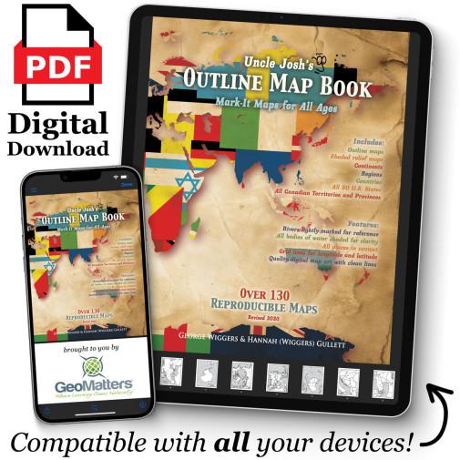
The digital version of Uncle Josh’s Maps provides an abundance of maps to be utilized for any historical era for geography purposes. This digital download includes more than 130 reproducible maps. Use these maps over and over again with children and grandchildren to come. PDF downloads are available on any device that has Acrobat Reader capabilities. ~Rebecca
Publisher's Description of Uncle Josh's Outline Map Book - Digital Download
Outline maps are a foundational part of teaching geography and history. Here are hundreds of maps to use year after year, regardless of topic or time studied. From drawing explorer's routes to tracking hurricanes to depicting the rise and fall of empires, it's here! Includes continents, ancient historical regions, important war arenas, each of the fifty states, and more! Rivers are lightly shaded and surrounding borders are visible. You've got the whole world covered! Reproducible pages.
This book edition contains 130+ reproducible maps. Used as a companion resource for Trail Guide to World Geography and Trail Guide to U.S. Geography.
Category Description for Uncle Josh's Outline Maps
From that mogul of maps, Josh Wiggers (of Geography Matters), comes this valuable resource with over 130 reproducible maps. Need a map for Hannibal's travels, hurricane tracking, or habitat studies? It's here! No more searching for that elusive map of ancient Greece! Includes maps of each of the fifty states, continents, ancient historical regions, and more. 136 pgs, pb. All of the outline maps from the book are also available in CD-ROM format with a few extras: Canadian Provinces and Territories, Ancient Civilizations, Mongols, Thirteen Colonies, 10/40 Window, and state maps with USA inserts. The following shaded relief outline maps are also included: Africa, Asia, Australia and New Zealand, Europe, North and South America, World, Pakistan and Afghanistan. In all, there are over 260 printable maps. Windows requirements: Windows 95 or later; Mac requirements: OS 9 or later; Acrobat 5.0 or above (included); and an inkjet or laser printed (recommended).
Details
| Product Format: | Other |
|---|---|
| Brand: | Geography Matters |
| Grades: | PK-AD |
Videos
Reviews