We use cookies to make your experience better. To comply with the new e-Privacy directive, we need to ask for your consent to set the cookies. Learn more.
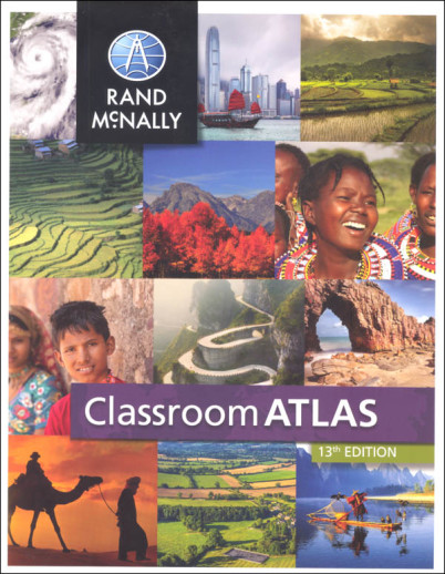
Classroom Atlas
SKU
036559
ISBN
9780528026591
Grade 4-9
Neutral
Non-Consumable
These icons are designed to help you quickly understand and learn important information about our products.
Teaching Method
Traditional
Teacher-centered curriculum commonly used in classrooms that may include a text, teacher manual, tests, etc.
Charlotte Mason
A methodology based on the work of a 19th century educator who maintained that children learn best from literature (Living Books), not textbooks.
Classical
A methodology based on the Latin Trivium (three stages of learning), including the grammar stage (memorization and facts), logic stage (critical thinking), and rhetoric stage (developing/defending ideas).
Unit Study
A thematic or topical approach centered around one topic that integrates multiple subject areas.
Montessori (Discovery)
A methodology based on the work of a 20th century educator that emphasizes student and sensory-driven discovery learning and real-life applications.
Other
Other methodologies
Religious Content
Secular
Contains content contrary to common Christian beliefs (i.e. evolution).
Neutral
Avoids religious or theoretical topics or presents multiple viewpoints without preference.
Christian/Religious
Faith-based or including instructional religious content.
Learning Modality
Auditory
Learns through listening, talking out loud or reading out loud.
Visual
Learns through seeing, prefers written instructions and visual materials.
Kinesthetic/Tactile (Hands-On)
Learns through moving, doing and touching.
Multi-Sensory
Curriculum that employ a variety of activities/components.
Presentation
Sequential
Curriculum progresses through well-defined learning objectives. Emphasizes mastery before moving to the next topic.
Spiral
Topics and concepts are repeated from level to level, adding more depth at each pass and connecting with review.
Conceptual/Topical
Focus is on the “why,” often with a unifying concept as well as specific skills; coverage may be broader.
Teacher Involvement
Low Teacher Involvement
Student-led materials; parent acts as a facilitator.
Medium Teacher Involvement
A mix of teacher-led time and independent student work.
High Teacher Involvement
Teacher-led lessons; may utilize discussions, hands-on activities and working together.
Additional Materials Required
No other materials needed
Everything you need is included.
Other Materials Required
There are additional required resources that are a separate purchase.
Other Materials Optional
There are additional resources mentioned or recommended but are not absolutely necessary.
Consumable
Consumable
Designed to be written in; not reusable.
Non-Consumable
Not designed to be written in; reusable.
Our Price
$15.00 $15.00 $12.95
Rainbow Savings: $2.05
Description
Colorful, appealing, and kid-friendly, the Classroom Atlas from Rand McNally is the next step up from the Junior Classroom Atlas (#007961) with more maps, more detail and more information. The book begins with a section defining map terminology. Next are nine world maps, each with a different emphasis: physical, political, climates, population density, and time zones, to name a few. Following are physical, political, and thematic maps for each continent. Thematic maps might showcase climate, environments, population, economic activities, natural hazards, or transportation. Each continent map section begins with an introduction that provides a historical and geographical overview of the continent, a timeline, and photos of people, places, animals, or landmarks from the continent. Additional maps are provided of the United States, Canada, and Mexico/Middle America. Graphs, charts, and "Did You Know?" fact boxes add visual interest and content. Interesting Top 10 lists (i.e. Largest lakes, longest rivers, most populated countries) are printed in the front and back inside cover. Index included. This is the 13th edition, copyright 2015 and includes North and South Sudan. 208 pgs, pb. ~ Lisa
Publisher's Description of Classroom Atlas
Give your intermediate student the advantage of working with this best-selling atlas. Clearly organized by continent, Rand McNally's Classroom Atlas is packed with photographs, graphs, critical-thinking questions, brain teasers, and charts that illustrate map concepts. Includes essential how-to information on using an atlas.
Details
| Product Format: | Softcover Book |
|---|---|
| Brand: | Rand McNally & Company |
| Grades: | 4-9 |
| ISBN: | 9780528026591 |
| Length in Inches: | 10.875 |
| Width in Inches: | 8.5 |
| Height in Inches: | 0.375 |
| Weight in Pounds: | 1.25 |
Videos
Reviews